
Drone Surveys in Cornwall: Aerial Data Capture for Land and Property Projects
- Aaron Bennett
- Mar 26
- 3 min read
Updated: Mar 28

Drone survey technology has transformed the way land and property data is captured across Cornwall and Devon. Where traditional ground-based methods alone would once have required significant time and resource, an unmanned aerial vehicle (UAV) can now capture accurate, high-resolution data across large or difficult-to-access areas in a fraction of the time.
At TruGrid Surveys Ltd, we provide drone survey services across Cornwall and Devon, combining UAV data capture with professional survey-grade processing to deliver orthophotos, digital terrain models, topographical data, and volumetric calculations for a wide range of construction, land management, and planning projects.
What is a Drone Survey?
A drone survey uses a UAV fitted with a high-resolution camera or sensor to systematically photograph or scan an area from the air. Those images are then processed using photogrammetry software to produce georeferenced outputs - including orthophotos (accurate aerial images corrected for distortion), digital terrain models (DTMs), digital surface models (DSMs), and point cloud data.
When combined with ground control points (GCPs) measured with a GNSS receiver or total station, drone surveys can achieve centimetre-level accuracy, making them suitable for use alongside or in place of traditional topographical survey methods for many project types.
Drone Survey Services We Provide
TruGrid Surveys Ltd offers a range of UAV survey services to clients across Cornwall and Devon, tailored to the requirements of each project.
Orthophoto and Aerial Mapping
We produce high-resolution, georeferenced orthophotos showing the true plan view of a site, corrected for camera tilt and terrain. These are used for site appraisals, planning applications, topographic base mapping, and visual records of sites before and during development.
Topographical Data Capture
For sites where a conventional ground survey is impractical or inefficient - large open areas, coastal land, steep terrain, or sites with limited access - drone data capture provides a fast and accurate alternative. We process the aerial imagery to generate DTMs and contour data that feed directly into a CAD drawing, in the same format as our ground-based topographical surveys.
Volumetric and Stockpile Surveys
Drone surveys are an efficient and reliable method for calculating the volume of stockpiles, earthwork mounds, excavations, and other material accumulations. Regular drone flights over a site allow cut and fill volumes to be tracked over time, supporting accurate cost reporting and materials management.
Site Progress Monitoring
Repeat drone flights at agreed intervals provide a clear visual and spatial record of site progress, useful for contractor reporting, client updates, and dispute resolution. Each flight produces a consistent, measurable dataset tied to the same coordinate system.
Why Drone Surveys Work Well in Cornwall
Cornwall's landscape presents some specific challenges for ground-based survey work. Coastal cliff edges, steep valley sides, dense vegetation, tidal zones, and large agricultural holdings can all make access difficult or time-consuming for a surveyor working on foot with a total station.
A drone can cover these areas efficiently, capturing data that would otherwise require significant additional time, specialist access equipment, or multiple site visits. This makes UAV surveys particularly well suited to the Cornwall and Devon environment, where ground conditions and terrain vary considerably from one site to the next.
Cornwall's historic mining landscapes, coastal headlands, and large rural land holdings are also well served by drone survey methods, where a plan-view dataset helps landowners, planners, and engineers understand the full extent of a site quickly and cost-effectively.
The TruGrid Drone Survey Process
We manage drone surveys from initial brief through to final deliverable, keeping the process clear and straightforward for our clients.
Flight Planning and Regulatory Compliance
All UAV operations are conducted in accordance with Civil Aviation Authority (CAA) regulations. We assess airspace restrictions, obtain any required permissions, and carry out pre-flight risk assessments for every survey. Where operations are in controlled airspace or require specific authorisation, we manage this as part of the project.
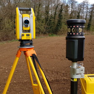
Ground Control and Survey Integration
To achieve survey-grade accuracy, we establish ground control points using GNSS equipment tied to the National Grid and Ordnance Datum Newlyn. These are used to georeference the drone imagery and ensure all outputs are in the correct coordinate and height system - consistent with any other survey data for the project.
Processing and Delivery
Imagery is processed using photogrammetry software to generate the agreed outputs - orthophotos, DTMs, contour data, point clouds, or volumetric reports. Deliverables are supplied in formats compatible with CAD, GIS, and BIM platforms, and we remain available to discuss the data and answer any questions after delivery.
Conclusion
Drone surveys offer a fast, accurate, and cost-effective way to capture land and site data, particularly on the type of challenging terrain found across Cornwall and Devon. When combined with proper survey control and professional processing, UAV data can match or complement ground-based survey outputs across a wide range of project types.
To discuss a drone survey requirement or request a free quotation, call TruGrid Surveys Ltd on 07977 816012 or email info@trugrid.co.uk. Most quotes are returned within 1-2 working days.

Comments