
Topographical Surveys in Cornwall: Laying the Groundwork for Successful Projects
- Aaron Bennett
- Dec 22, 2025
- 3 min read
Updated: Mar 26
Topographical surveys are a crucial first step for many planning and construction projects across Cornwall, from coastal plots near St Ives to tight urban infill sites in Truro. They give architects, engineers, and homeowners an accurate picture of the land as it really is, before any design work begins.
At TruGrid Surveys Ltd, we provide detailed topographical surveys across Cornwall and Devon, delivering clear CAD drawings and 3D data that help keep projects on programme and within budget.

What is a Topographical Survey?
A topographical survey is an accurate, measured representation of a piece of land, recording both its three-dimensional form and the features present on and around it. A complete topo survey typically captures:
Ground levels and spot heights across the site, including contours showing the shape of the terrain
Boundaries, walls, fences, hedges and other built and natural features with their heights
Trees, vegetation, watercourses, ponds and other natural landscape features
Buildings, roads, paths, structures and their eave and ridge heights
Manhole covers, drainage features and overhead services where required
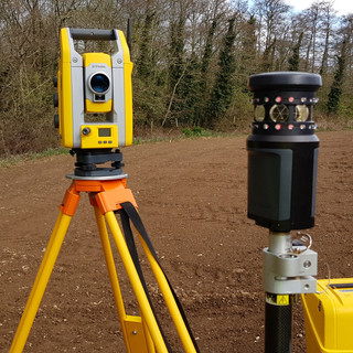
At TruGrid, surveys are captured using robotic total stations, GNSS (GPS), and 3D laser scanning where beneficial, and issued in DWG, PDF and other formats to suit your design workflow.
Why Topographical Surveys Matter in Cornwall
Cornwall's geology, steep valleys, coastal edges, and historic settlements make reliable survey data especially important.
Planning and Design Confidence
Local architects and engineers rely on topographical surveys to design extensions, new builds, farm conversions and infrastructure that respond correctly to existing levels and neighbouring properties. This reduces re-design and helps support planning applications with accurate information.
Supporting Planning Applications
Many planning submissions benefit from or effectively require a topographical base plan to show existing site conditions, boundaries, and relationships to nearby buildings. In Cornwall, this is particularly relevant in sensitive locations such as conservation areas, coastal zones, and flood risk areas.
Cost and Risk Reduction
Understanding gradients, access constraints, and drainage routes early helps identify retaining requirements, cut/fill balances, and potential issues before you're on site. That typically leads to fewer surprises for contractors and more accurate cost plans.
The TruGrid Survey Process
We keep the process straightforward while maintaining high technical standards.
Brief and Desktop Review
We discuss your project, planning status, and required level of detail, then review existing information such as title plans, architect's sketches, and any previous surveys.
Site Work Across Cornwall and Devon
Using Trimble robotic total stations, GNSS and, where appropriate, 3D laser scanning, we capture all agreed features and levels on site, from small residential plots to larger commercial and agricultural land.
Processing and CAD Drafting
Data is processed into a clean CAD drawing with clear layers, line types, and annotations so that architects, engineers and planners can interpret the survey quickly.
Delivery and Ongoing Support
Final drawings are typically supplied in DWG and PDF, with point clouds or 3D surfaces available where required. We remain available to answer questions, provide additional sections, or adapt the survey to suit developing designs.
Typical Projects We Support in Cornwall
TruGrid's topographical surveys are used on a wide range of local schemes.
Site Development
Residential extensions and new dwellings, from village infill plots to replacement dwellings on the coast.
Barn and Farm Building Conversions
Requiring accurate levels, access, and drainage information.
Commercial and Highway Projects
Around Truro and key transport routes where gradients and visibility are critical.
Conclusion
Getting your topographical survey right at the start saves time, cost and stress throughout the rest of your project. Cornwall's varied terrain means site conditions can catch you out - but with accurate levels, boundaries and feature data from the outset, your architect, engineer or contractor has everything they need to work with confidence.
To discuss your project or request a free quotation, call TruGrid Surveys on 07977 816012 or email info@trugrid.co.uk. Most quotes are returned within 1–2 working days.
Comments